A Complete Trekking Guide to the Pin Parvati Pass Trek
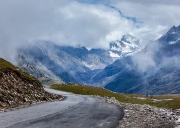
Who doesn’t love a thrilling adventure among the snowy mountains and uncertain terrains? Love to tread off the beaten tracks? If yes, then the Pin Parvati Pass Trek is the perfect choice for you. Are you wondering where is pin parvati pass? Spanning the Pin Valley of Spiti to the Parvati Valley of Kullu, the Pin Parvati Pass lies at an alluring height of 5319 mts. which is a delight for seasoned trekkers.
The long arduous trek is situated so high up that the oxygen layer is low, making this trek suitable only for seasoned trekkers who are acclimatized with high altitude trekking. Spanning over a length of 17457 ft. is an experience which would revel you for a lifetime. The Buddhist villages of Pin Valley slowly gives way to the verdant meadows and lush green forests of Parvati Valley.
When and how to go
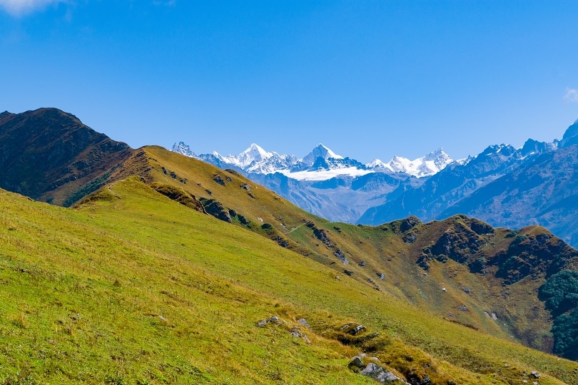
The ideal time to plan a trek to Pin Parvati Pass is the peak of the summer season when the blazing heat gets unbearable. Escaping to the icy winds and cool breezes of the Pain Parvati Pass is incentive enough for any trekker worth their salt to pack up and leave for the place. The months of May to September are ideal for planning a trip to the pass.
The nearest railhead is Pathankot from where Manali is accessible by road. The nearest airport is Bhuntar which is located 52 kms away from Manali. Cabs are easily available from there to Manali. Manali is well-connected with Delhi by road and hence is accessible by road.
The beginning

Once you reach Manali you take a cab and drive out of Manali via the Rohtang Pass and keep moving towards Batal. Upon reaching Gramphu you will find the Gramphu-Batal-Kaza road along the way. Upon taking that road you would reach Batal from where the real Spiti Valley starts. Camping facilities are available on the riverbanks where the acclimatization process start.
Along the way to Spiti beautiful villages, lush golden meadows and coniferous forests lie on either side. The river bank offers a chilly breeze which is both refreshing and daunting at the same time. At this 3800 m height, you will start the acclimatization process after reaching there after a 10-12 hour drive. The second day is used for acclimatization and the next day the real trek starts. The day begins with a drive down to the Mudh village at an altitude of 3744 m. The distance is about 49 km which takes around 2-3 hours for the drive to be completed. Mudh is a village which is perfect with white washed houses and barley fields and makes it look like someone picked them up and placed them there, straight out of a Hollywood movie.
Once at Mudh, the trek begins to the Tiya situated at an altitude of 3900 m. The trek is a very gradual ascent gradient and is hence is easy to undertake. You would reach Tiya within 3-4 hours. Mudh would be the last village you get to see before the next day. Also even though there would be river nearby, the Himalaya trekking trail is considerably higher than the river bed and hence there is no chance of refilling water.
So you have to carry all the water that you would need. The gradual trek would leave you with plenty of room to enjoy the cascading river and the colourful shale mountains typical to Spiti all along the way. Upon reaching Tiya you have to look for a camping spot as its elusive at times. This place is also known as snow leopard valley or ibex country but their shy and elusive nature makes it impossible for travelers to spot them amidst the wilderness.
Walking through the clouds

The trek starts from Tiya with the trekkers having to cross sections of sedimentary rocks and cross the river before climbing up on the other side and continuing their journey over scree laden narrow paths and shale woven trails. The entire trek presents a picturesque view of Spiti Valley as you ascend to 4500 m. the sharp ascents make it a challenging prospect even for the best of trekkers. But the rewarding view is enough to make your heart soar. The streams along the way are drinkable, at least a couple of them are and hence drinking water is going to be available enroute.
The Pin glacier becomes visible from Shiya where you camp for the night. The next day takes you through the rugged Himalayan terrains and fast flowing rivers which can sweep you away to your death. This is a team effort as the river has to be crossing by roping up all the members together and then going across one by one. The Pin Base Camp is situated at a height of 4800 m from where the Pin Pass lies at a height of 1000 ft.
The ascent to the Pin Pass is grueling as the high altitude adds to the woes. But the bird’s eye view from the top of the Pass is going to make you forget all your trouble and enjoy the panoramic view all around. Numerous peaks are visible from this point as well as the Mantalai base camp which is your next destination. The descent is brutal and at times dangerous as the hidden crevasses in the snow pose a terrible threat. After that the muddy valley gives way to shale and scree laden trails up to Mantalai Lake where you take a day off and recover.
The beginning of the end
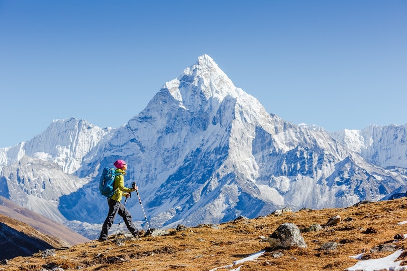
From Mantalai Lake you have to trek down some really steep gradients to reach Odi Thach at 3815 m as you get greeted by a valley full of red, pink and purple blossoms. The stark difference of this place with the barren Spiti valley is going to come into sharp contrast.
The next stop is Tunda Bhuj campsite at 3200 m which is reached through a dangerous trail by the side and over the Parvati River. From there the next destination is Kheerganga which would be the first village you see after the Mudh Village. From here you descend for three hours to Barshaini where the trek officially ends.
Sounds dangerous. Is it really worth it?
Remember that cheesy tagline from Mountain Dew? ‘Dar ke aage jeet hai’. Well no matter how cheesy it sounds it’s not wrong. The most dangerous things end up being the most beautiful ones. So go gather your courage, pack a bag and get going. Also if you don’t go, you are going to regret it for your entire life. Trekking in Himachal is a life rejuvenating experience for all!
Recent Posts
Top Picks
- OYO
 15 April, 2024
 - Cultural Tour

- OYO
 15 April, 2024
 - Cultural Tour

- OYO
 15 April, 2024
 - Cultural Tour

- OYO
 15 April, 2024
 - Cultural Tour

- OYO
 15 April, 2024
 - Cultural Tour

Please rotate your device
Please go back to portrait mode for the best experience



 April 15, 2024